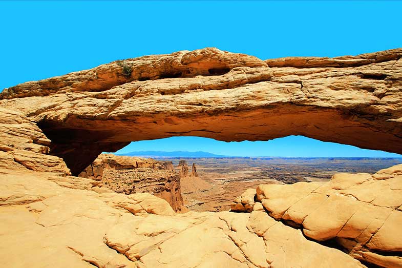
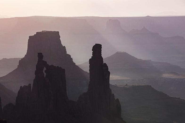
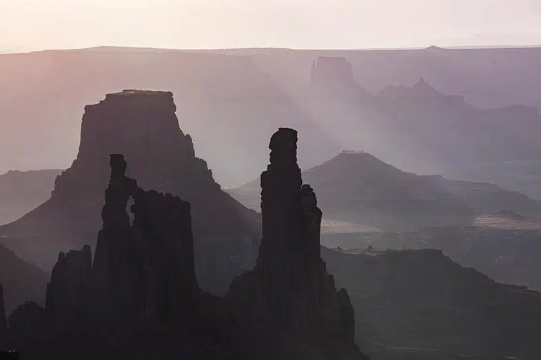
Established in the 1950s, the White Rim Trail is arguably the best-kept outdoor secret of Utah. Every turn of this 71.2-mile stretch provides an enjoyable riding experience with stunning landscapes to enjoy. It leads to beautiful arches, stone towers, dramatic canyons, spine-tingling cliffs, and other fantastic red rock formations.
The White Rim Trail is an excellent off-road destination for anyone visiting Utah’s canyon country. It is a famous long-distance bike route and a sought-after 4×4 trail that offers lots of cliff-side driving and slow-crawling sections. The White Rim never fails to thrill and inspire.
This hidden jewel in the Canyonlands National Park is one place you should not miss. While admiring the splendid scenery throughout the trail, you still need to keep an eye for random rocks and dips. There’s also no cell service, so you need to prepare well before going on this adventure.

This article will go over trail directions, vehicle requirements, and park regulations. We’ll also go over a little bit of history and precautionary measures to observe while traversing the White Rim Trail Moab.
White Rim Trail: Utah’s Scarlet Gem
The 71.2-mile White Rim Trail is a point-to-point off-road vehicle route through the Canyonlands National Park. The Atomic Energy Commission constructed the road in the 1950s to provide Uranium production during the Cold War. Thankfully, there were little Uranium deposits found in the area; otherwise, White Rim Trail would probably be a nuclear power plant and not the off-roading destination today.
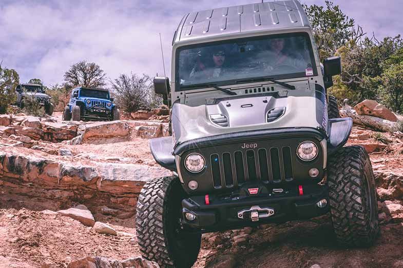
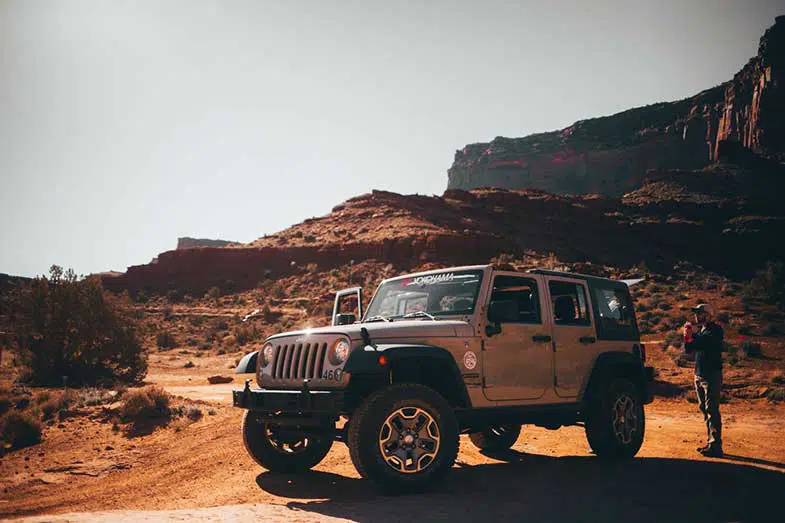
The terrain’s overall appeal makes you feel like you were on Mars rather than a desert. The trail’s surface is made up of loose dirt, sandy washes, and sandstone rock formations. 4WD vehicles and mountain bikes are most common, although street-legal, registered motorbikes are also allowed to travel on the road.
Horseback riding and hiking are also permitted. There are steep inclines on the trail for 4×4 vehicles and small areas where you can pull off the side and eat or take lots of Instagram-worthy pictures.

How Long is the White Rim Trail?
The length of the White Rim Trail Canyonlands differs depending on how it is measured. The trail measures 71.2 miles from Shafer Trail junction to Mineral Bottom Road, both defined as the route’s endpoints. If we include both access roads but none of the spur roads, the total distance changes to 89.4 miles.
Excluding the access roads but including round-trips on all spur roads, the length becomes 92 miles. If we don’t leave out any access road or spur road, the overall distance is 110.2 miles.
When Does the White Rim Trail Open?
The park is open year-round and accessible from either Mineral Bottom Road (also called Horsethief Trail) in the west or Shafer Trail. Both roads are junctions off Island in the Sky Visitor Center, an extension of Utah State Route 313.
What are the White Rim Trail’s Busiest Months?
Busiest months are between March and October, particularly on weeks surrounding Easter, Memorial Day, Labor Day, and Utah Education Association break. The Utah Department of Transportation Traffic website provides traffic conditions outside the park.
Directions to White Rim
- Shafer to Airport (Mile 19): Starting on Shafer Trail from the Island in the Sky mesa, you’ll encounter hairpin turns and exposed cliffs. This section is steep and exciting. It quickly brings you from the top to the junction with Potash Road. After 0.6 miles, you will see the first river at Gooseneck Overlook, followed by views of Musselman Arch and Airport Tower Butte. A steep 4-mile spur road leads down to the Colorado River through Lathrop Canyon.
- White Crack (Mile 39): Back on the White Rim Road, you’ll pass Buck Canyon, Gooseberry Canyon, and the rock pinnacles of Monument Basin. Washer Woman Arch, a series of three large sandstone spikes, is a highlight in this section. As you ride towards Gooseberry, it will be on your right. From here, turn off the main route and go uphill to access the White Crack campground. This intersection transitions from the Colorado River to the Green River side of Canyonlands National Park.
- Murphy Hogback (Mile 45): The next challenge occurs halfway through the Murphy Hogback route. Expect a very steep and rocky climb to the top of the pass. This portion is badly washed out but is passable in 4 Lo with some skill. Once you have completed the climb, you reach Murphy A – a great campsite that is neck in neck with White Crack for those who’ve been to the area. The mesa edge here makes a spectacular place to camp and watch the beautiful sunset. You can also see the Turks Head Butte from the edge of a plateau.
Canyonlands White Rim Trail
- Candlestick to Potato Bottom (Mile 66): After the Hogback, the route goes downhill to Candlestick Tower, an open campsite close to the rim with great views of the Green River below. The downhill trend continues to Potato Bottom, where you’ll pass a few vertigo-inducing sights along the way. As you approach the river, you’ll notice terrain with a few more bits of vegetation. There are even plants with a small plastic dipper latched to a stick and signage saying, “Water me, please.” You cannot help but water them.
- Hardscrabble Hill (Mile 66): What comes next is a 3-mile trail to Fort Bottom Ruin, followed by a steep, rocky road at Hardscrabble. It’s a short distance from Potato Bottom with a loose, technical climb in between. A 4WD support vehicle is much needed. It is steep, narrow, and winding, and allows zero room for error. But due to some maintenance done recently, this part of the road is in great shape.
- Labyrinth to Mineral Bottom (Mile 92): From Hardscrabble, you arrive at the Labyrinth intersection. Turn right and head inward to find Taylor campground. A 5-mile spur road gives you access to the majestic Zeus and Moses formation from this campsite. After crossing arroyos, the White Rim Road ends just outside the national park boundary at Mineral Bottom Road.
White Rim Trail Difficulty
White Rim Trail conditions range from intermediate to highly technical. It is rated moderately difficult for high-clearance, 4WD vehicles in fair weather conditions. There are portions of the route where one wrong may be disastrous, and tricky sections requiring three-point turns.
The most difficult is the Shafer Trail and Mineral Bottom Road switchbacks, Murphy Hogback, Hardscrabble Hill, and the Lathrop Canyon Road – an optional spur road. Although challenging, these steep, exposed sections make the White Rim Trail an exciting ride.
Weather Conditions
The weather in this zone is harsh and highly unpredictable. Sometimes, portions of the road may be temporarily closed due to road work, inclement weather, or flooding during high water events. Rain and snow can quickly change unpaved roads to 4WD conditions or make them impassable.
Heavy downpours make some sections of the trail muddy, which proves to be a challenge for mountain bikers despite having large tires.
How Long Does it Take to Complete the White Rim Trail?
The route is best completed in 2-3 days while staying in designated campgrounds. It could take longer if you traverse all the spur roads, or take lots of photos. Both 4×4 vehicles and mountain bikers can travel the trail in either direction.
According to off-roaders who’ve been here, it is faster to complete the route if you go counterclockwise (starting from Mineral Bottom Road) compared to starting at Shafer.
Vehicle Requirements
White Rim Trail vehicle requirements entail that all motorized vehicles, including motorbikes, be registered, street-legal, and operated by licensed drivers only. The trail requires a high-clearance, 4WD vehicle with a low gear range.
Front or rear-wheel-drive only vehicles, automatic all-wheel drive, and low-clearance vehicles are not allowed. ATVs/UTVs and OHVs are not permitted. Additionally, all modes of transport must remain on the road surface.
White Rim Trail Permits and Group Sizes
Since September 2015, White Rim Trail has required both day-use and overnight trip permits. NPS issues a maximum of 100 of these per day, with 50 reserved for motorized vehicles and 50 for bicycles. Half of the count for each vehicle type is available on the trip, and the other half is used for reservations.
In spring and fall months, the demand for permits frequently exceeds the number available, so visitors must make advanced White Rim Trail reservations. Currently, passes are issued online only and not at park visitor centers. You must request overnight permits at least two days before your trip start date, and day-use permits up to 24 hours before.
Each vehicle and bicycle group requires a permit. This rule includes any stowed bikes you will use at any point along the road. Also, NPS has set group size limits to ensure a better wilderness experience for all visitors. Groups are limited to three motor vehicles and 15 bicycles. They should leave 30 minutes apart to minimize dust and the potential crowding of several groups in one area for larger groups.
Horses, burros, and mules are allowed on the White Rim Trail Utah with a permit, but pets are not. Day-use group limits are no more than ten people and ten animals. Overnight group limits are seven people and ten animals. Overnight trips also incur a $30 backcountry fee, but day-use permits are free. You should feed these animals pelletized food (to reduce the chance of spreading non-native plant seeds through manure).
White Rim Trail Campgrounds and Overnight Stays
If you stay overnight, you must camp in one of the twenty sites within ten campground areas. They are scattered along the White Rim Trail 4×4 road and some of its spurs. All overnight stays require a backcountry permit and a $30 fee, and can only extend up to 14 consecutive nights.
Adventure seekers often stay at Potato Bottom, or the more esteemed Murphy Hogback and White Crack campgrounds. You don’t have to rent an actual campground, provided you have primitive camping gear, and you stay in designated areas. Choose a location close to pit toilets (these look like fancy port-a-potties and are quite comfortable to use). Note campfires are not allowed anywhere along the route.
Recommended Tours
If you plan do White Rim Trail in a day, you may only complete a portion of the 71.2-mile track. While this is true, you still can get the most out of your visit with incredible tour packages. Navtec Expeditions provides a guided tour where you ride for half of the day and the spend the remainder hiking and discovering hidden passages.
Rim Tours is the most popular tour for mountain bikers and has been an outfitter since 1985. They offer three or four-day packages. On the four-day tour, bikers ride approximately 20 – 25 miles each day. On the three-day tour, bikers ride about 30 – 35 miles each day. They usually run the road clockwise. But on certain occasions, they run the route in the opposite, counterclockwise direction, depending on the campsites assigned by the park service.
Booking tours through Viator is a more luxurious option but only provides a full-day tour with an expert guide. This tour includes Island in the Sky, Gooseneck overlook, Musselman Arch, Lathrop Canyon, and the Shafer Trail leading to the Colorado River.
Plus, optional guided hikes take you to hidden caverns and other stunning locations, such as the caves of Canyonlands. The tour also includes buffet lunch and round-trip 4WD transport from Moab.

Unfortunate Events
It is difficult to find a definitive number of White Rim Trail deaths. Several factors ranging from falling off a cliff to having a heart attack on the trail result in accidental deaths. Some incidents made it to the headlines, but a centralized death toll repository per national park has yet to happen.
10 Tips for White Rim Trail Off-Roading
Here are some tips to follow while traversing the White Rim Trail:
- Never travel alone. Remember that you are miles away from help if anything were to happen and would be unlikely to come across any other vehicle except when near Shafer (this is not even a guarantee). If you are renting a 4×4 or have purchased a package, make sure to provide the tour company an emergency contact if you go missing.
- Do not go on this trail if you are afraid of heights or very tight switchbacks. Some parts of it can cause dizziness and may lead to accidents. This advice goes for both taking on the trail clockwise or counterclockwise.
- A paper White Rim Trail map with mile markers is a must. Also, some tricky sections require an experienced spotter to help you out. If you do not have any with you, do not hesitate to get out of your car and see where the road goes as there are lots of steep, blind turns along the route. Additionally, make sure to purchase one of the trail books for a quick history lesson about the place and side-hike ideas.
- Heed any warning about driving in extreme heat or cold. Choose more temperate seasons or months within the year.
- Because this route is very remote with no potable water anywhere and no stores nearby, bring lots of water. NPS even recommends mountain bikers and bicyclists to have a motorized support vehicle to carry water when traveling. There are few river access points, with the Green River being accessible only at spots along the western end of the road and Lathrop Canyon being the only access point to the Colorado River near the eastern terminus.
- Take caution when driving on the trail. Don’t forget that you can only average 5-10 miles per hour. There are sections on the route with very few turnouts for vehicles to pass each other. So be ready for some hair-raising experiences depending on who else is coming from the opposite direction.
- You and your vehicle will generally bounce across the slick rock, so be sure to secure everything in place. If you bring cameras or anything else delicate, you need to pack them in serious packing material.
- Rest when you need to. Driving on the White Rim Trail can be very exhausting. Take lots of breaks when you’re tired because you’ll need to be alert, especially if you’re the driver.
- Due to the reopening of the Canyonlands National Park, parking lots and trails are crowded. Exercise patience as wait times at the entrance gate may exceed 30 minutes, and staff may need to delay vehicles from entering when parking lots fill.
- The White Rim Road is 100 miles in overall length. Therefore, it is advisable to camp at least 1-2 nights. However, be aware that there are limited group campsites across the trail that fill up quickly, so make sure to reserve early.
White Rim Trail – Discovering the Ancient West
There is so much to explore on the White Rim Trail in Utah. The park holds so much history – its winding road was once a means to transport Uranium deposits to produce nuclear weapons. Jeepers consider it a generally safe trail but sometimes wide enough for only one vehicle in some places.
Cyclists consider it one of their biggest challenges where they test their physical and mental strength. On one side, it is bordered by cliffs and on the other, by steep declines unprotected by guardrails. Sign up for a White Rim Trail Jeep tour, or brave it with your friends.
Standing on the top of the rim while looking down at a thousand feet of sandstone layers is awe-inspiring, and has meant different things to many people. For some, it offers peace and tranquility and a path to a spiritual rebirth.
To others, it is a reprieve from city life. For many, it is a place where they can test their resourcefulness and off-roading prowess, having to survive many days only with the provisions they bring along. But for you, this could be a special place where you can test your resolve, or enjoy a weekend getaway riding on lifted 4x4s or bicycle tires.
Kris is an avid off-roader and outdoor enthusiast who loves to brave the elements and take on challenging terrain. He also enjoys sharing his passion and knowledge with others so that they, too, can appreciate the ride.
About Kris